For about a decade or so, I’ve been a(n active) member of Big Bend Chat, an old-school forum for all things Big Bend and surrounding areas. This year (2025), BBC is celebrating its 20th anniversary. Those of us who were able to make it met on December 12.
I was able to make a quick solo trip, during which I got in two hikes. My first was Lone Mountain, which is, as of this writing, the newest trail in the park. It is a pretty easy loop, just under 3 miles in length, around the eroded remains of an igneous intrusion. As with any desert hike, it gets hot even when the temperature isn’t particularly high. I believe it was no higher than the 70s, and possibly a little cooler than that.
I chose this hike because, for one thing, I hadn’t done it before, but more importantly, I always choose the wrong first hike. I am essentially coming from sea level (my home is around 150′), and I have a tendency to do a more strenuous hike on my first day. Given that I live in a pretty flat location, I can’t exactly train for terrain. It turns out, I made a good decision. There were small sections that were a little more rugged than I expected, but I was able to get acclimated, which came in handy on my hike the next day.
Lone Mountain
The first picture is taken from near the trailhead and gives a view of Lone Mountain. Calling it a mountain is rather generous. It’s a hill with only a few hundred feet at best of elevation change.

Here we simply have a cholla cactus I found along the trail.

Another view of Lone Mountain with the moon above it. I enjoy creating these other-worldly B&W images.

My background is geology, and I can’t pass up interesting rocks. This mountain is an igneous intrusion, and sometimes the trail gives you a good view of what it “really” looks like.

And sometimes, you just have interesting boulders.

This last picture is of Alsate, lying in eternal repose in his mountains.

I use Caltopo for mapping and tracking my hikes. This is the Lone Mountain Hike:

Lost Mine
My main hike was Lost Mine. This is my second time doing this hike, the first being in March of 2018. It has about 1100′ of vertical elevation gain in about 3.5-4 miles. It is an out-and-back hike with a significant amount of the elevation gain, maybe 600′, in about a mile.
I originally thought I might do the first 1-2 miles, to an overlook that has good views of Juniper Canyon. I decided to do the full thing, which was probably not a good idea.
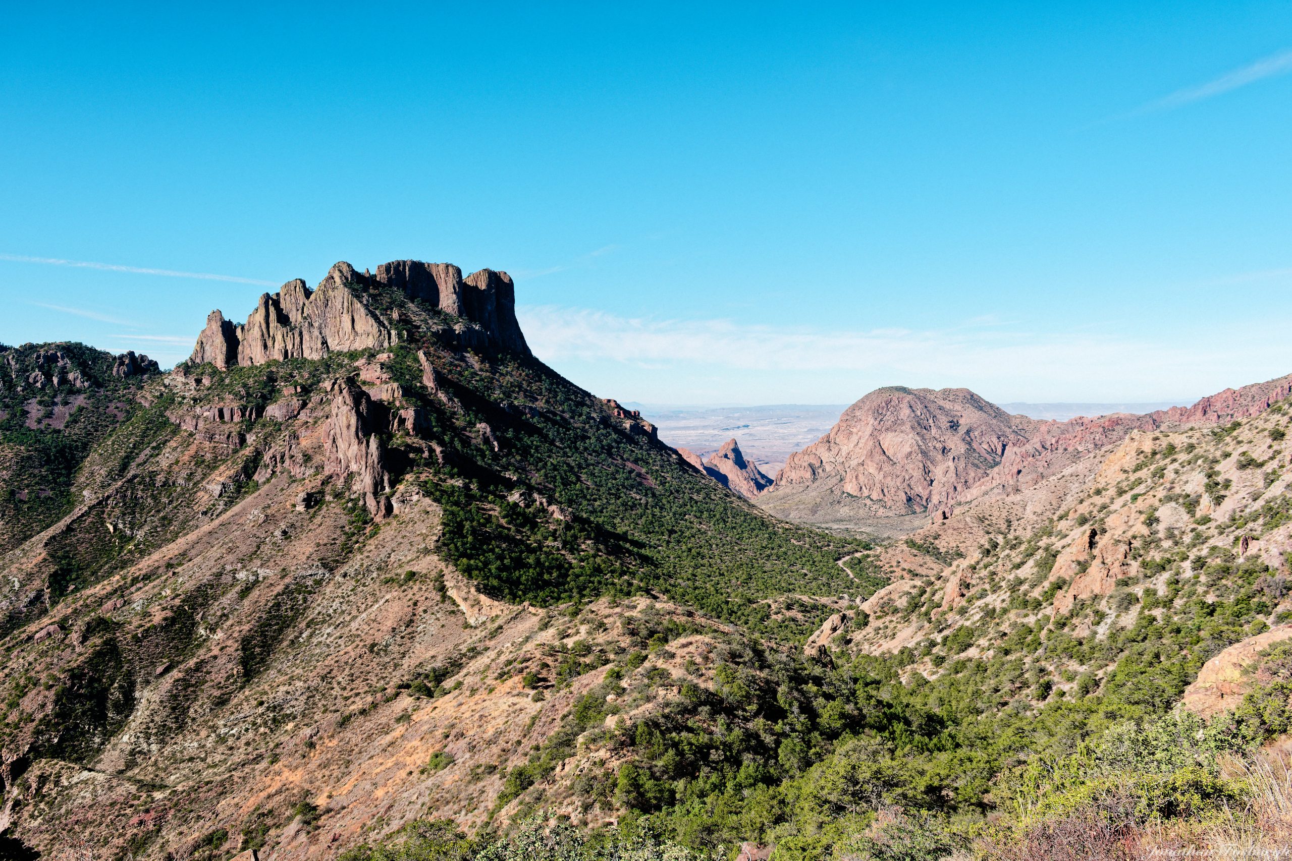
These first few images are of Green Gulch and the surrounding mountains. Green Gulch is the route you drive through to get into the Chisos Basin.


Next up, some interesting rocks. The Chisos are the remains of ancient volcanic eruptions. Hence, lots of cool crystalline rocks.

This is Casa Grande from an angle not everyone will see. Casa Grande is one of the iconic peaks of Big Bend.

This picture is one of the walls of Juniper Canyon. Unfortunately, the haze was too bad the day I was there. and so I didn’t get any usable pictures of the canyon.

While taking a breather at the Juniper Canyon overlook, I caught this Mexican Jay.

The Lost Mine Trail doesn’t actually go up Lost Mine Peak. Rather, it goes to a saddle between Casa Grande and Lost Mine Peak. Casa Grande is a fixture of the hike.

These two views are from the top of the trail. You have expansive views of the Basin and the Window in the distance.


This is my uphill log for this trail. The downhill log has some data artifacts.

I spent some time in the Basin recovering from my hike before going back to my hotel to shower and change before dinner. Casa Grande from the Basin.

I don’t know what this rubble pile is called, but it is one of my wife’s favorite formations in the park.

What follows are a collection of views of the Window and some of the surrounding mountains. The final image is possibly my final view of the Window from inside the Basin for several years.


